
BEIJING - The State Flood Control and Drought Relief Headquarters on Wednesday raised its emergency response for flood and typhoon prevention from level IV to level III in Hainan as Typhoon Yagi approaches land.
Typhoon Yagi, the 11th typhoon of the year as counted by China's meteorological authorities, is expected to make landfall along the coastal areas from Wanning in Hainan to Dianbai in Guangdong on Friday. Meteorologists predict peak wind speeds ranging from levels 15 to 17.
On Tuesday evening, the headquarters activated a Level-IV emergency response to flooding in Guangdong.
China's National Meteorological Center launched a red alert for Typhoon Yagi, saying that it grew into a strong typhoon on Wednesday afternoon.
The center warned that gales will batter the Taiwan Strait, parts of the South China Sea, the Bashi Channel, the central and south coastal areas of Fujian, as well as the central and eastern coastal areas of Guangdong from Wednesday night to Thursday night.
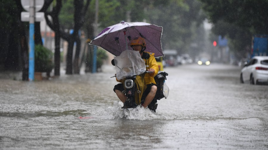
READ MORE: Heavy rains, flooding forecast in Beijing, surrounding regions
In the meantime, heavy rainfall is expected to hit parts of Taiwan Island, Guangdong and Hainan Island, according to the center.
China has a four-tier, color-coded weather warning system, with red representing the most severe warning, followed by orange, yellow and blue.
Floods and landslides caused by tropical storm Yagi have killed 12 people in the Philippines, the country's Office of Civil Defense announced on Tuesday.
ALSO READ: Floods, landslides in Philippines kill 10
Cities and counties on the trajectory of Typhoon Yagi are preparing for heavy rainfall and impending landfall, with expected rainfall totals ranging from 250 to 350 millimeters. Some areas may experience rainfall exceeding 400 mm from Thursday night through Saturday daytime.
On Tuesday, the Hainan Maritime Safety Administration urged over 2,200 transport vessels within its jurisdiction to implement typhoon prevention measures by returning to port and seeking safe harbor. All shipping routes are slated to halt operations by 6 pm on Wednesday, and other underwater and wind power projects must cease work by noon on the same day.
Haikou's Xinhai Port suspended operations starting Wednesday, and Xiuying Port and South Railway Port are set to do the same on Thursday. The decision to resume port activities will depend on the prevailing wind conditions in the Qiongzhou Strait.
The Department of Agriculture and Rural Affairs of Hainan Province and the provincial meteorological bureau issued a high-risk warning for heavy rain-induced hazards for late-season rice crops. The forthcoming typhoon's intense precipitation is expected to pose a high risk to late-season rice crops in Qionghai, Wanning, Wenchang, Haikou and Ding'an. Farmers are advised to take prompt action to minimize the negative impacts of the typhoon-induced heavy rainfall.
ALSO READ: HK issues T3 storm warning as Severe Typhoon Yagi intensifies
Hainan experienced a typhoon-free August this year, resulting in a decrease in precipitation. Authorities reported a monthly rainfall of only 142.3 mm, indicating a 53.2 percent reduction compared to last year.
The island also had an average temperature of 29 C, 1.3 C higher than the typical annual average, which has led to meteorological drought conditions in various regions.
Meteorological experts predict that from Sept 1 to Nov 15, Hainan province may experience five tropical cyclones, possibly one to two of them making landfall. This could result in a heightened risk of severe tropical cyclone-related disasters compared to the region's usual experience during this period.